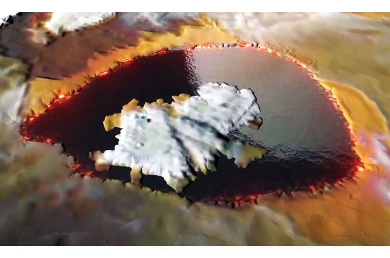
In-depth maps of Lake Rotorua have revealed its hidden mysteries beneath the surface.
This lake is located in New Zealand on the enormous, long-ago crater of a dormant volcano.
The maps were created by GNS Science researchers and show a range of phenomena, including hydrothermal explosion craters, remnants of an ancient river, and a significant magnetic anomaly in the southern part of the lake.
The release stated that scientists used a range of measurement techniques, mostly gravity, magnetic, and heat flow-based, to delve beyond the surface of the lake.
They were able to comprehend the geological context of this famous lake better as a result.
The detailed mapping identified areas in the lake where hydrothermal activity is still occurring and confirmed its existence.
“It’s a prime example of a holistic approach to understanding our geothermal-hosted volcanic lakes, empowering us to better model the intricate workings of the Rotorua geothermal system that projects offshore from Sulphur Point,” said Cornel de Ronde, the researcher.
The anomaly caused by magnetism
A huge area of 21 square miles (55 square kilometers), or over 68 percent of the lake’s floor, is depicted on the maps.
A small magnetic anomaly at Lake Rotorua’s core was discovered during the magnetic scan.
Strongly magnetic magnetite is found in volcanic rocks, according to Live Science.
But specialists think that in this particular lake, hydrothermal fluids have seeped into the rocks, turning magnetite into pyrite. Pyrite lacks a magnetic signature, in contrast to magnetite.
The apparent abnormality in the magnetic survey data is thought to be explained by the significant reduction of the magnetic signal caused by the hydrothermal process.
For the first time, hydrothermal system activity is recorded.
Numerous hydrothermal eruption craters on the map indicate that an active undersea hydrothermal system is present, according to the statement.
This active system was found off Sulphur Point, the southernmost point of this lake, not far from the centre of Rotorua city.
Based on survey data, it appears that these craters have been releasing gas and highly hot water.
Researchers note that the bottom of the lake typically maintains water temperatures at 57 degrees Fahrenheit (14 degrees Celsius), despite the intense activity.
This is because the lake is large enough to contain enough cold water to offset the heat rising from below.
In addition, there is very little variation in the temperature over a month—about 1.8 degrees Fahrenheit or 1 degree Celsius.
Paul Scholes, Senior Environmental Scientist at Bay of Plenty Regional Council Toi Moana, said, “The new maps are fundamental in assisting Bay of Plenty Regional Council and the wider community in managing the lake and its associated geothermal resources.”
“The geographical and geological information added provides invaluable information to the taonga that are the Te Arawa Rotorua lakes and the series of maps being developed provides a great resource for our community,” said Scholes in the press release.
Topics #Lake Rotorua #Magnetic Anomaly